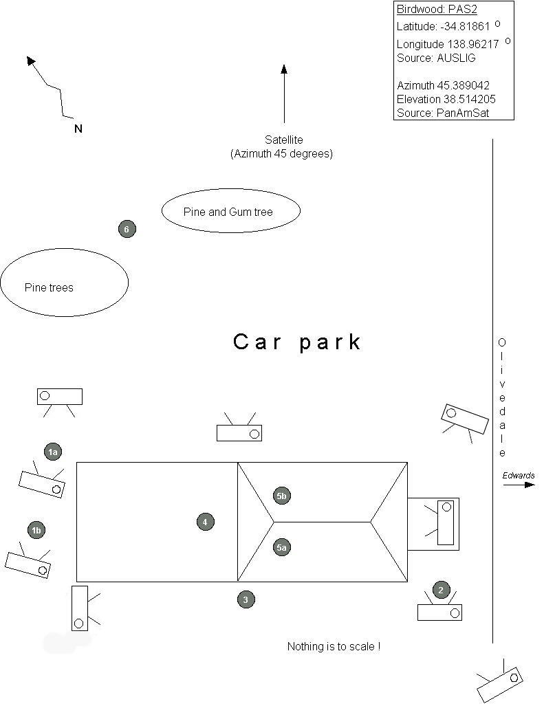
Click on a number or a camera on the diagram below. There is also a smaller version.
The diagram below shows some possible locations of a Satelite dish for Birdwood. Click on a number or a camera for more information about each site. Alignment information was from the internet: Auslig and PanAmSat.
Equipment used for checking alignment: magnetic compass, compass, projector stand, spirit level, cardboard alignment tool. The cardboard was cut to 38 degrees and a small 'T' piece taped near the top of the apex. This can be seen in the photographs if one looks hard enough.
Please note that this list is not exhaustive. Other locations may exist. Suggestions and corrections are welcome.
Click on a number or a camera. If your browser doesn't support client-side image maps, use the links below: